Translate

My social links

Thursday, 24 July 2014

Annapurna Base Camp Trekking


Annapurna Base Camp


Annapurna Trekking is the most popular trekking trails of Nepal and even one of the best trekking in Nepal. This region lies in the central north part of Nepal is named after the popular Annapurna Himalayan Rage. Trekking in Annapurna region is the best of Nepal treks and during this trek you not only witness the panoramic views of Himalayas but equally the rich flora and fauna along with amazing blending of culture and lifestyle. Well, Annapurna Region is famous for trekking, expedition, hiking, and climbing. Evidently, Annapurna trekking trails are decorated by the nature and panoramic Himalayan scenery. Annapurna Region is diverse naturally and culturally. Annapurna Region is easily accessible from Pokhara and the region where every trekker marvels over the magnificent sceneries that the Annapurna region offers and its unspoiled biodiversity. In addition to that, you will also get to see wild animals like Himalayan Thar, Musk Deer, Leopards, and different species of birds also. The popular destinations in Annapurna Area are Annapurna Base Camp, Ghorepani Poon Hill, Jomsom Muktinath, Annapurna Circuit,  and so on. Annpurna region is protected by Annapurna Conservation Area.One of the surveys undertaken by American organizations pointed out that Annapurna Region is one of the best trekking trails of the world which offers splendid varieties of natural and cultural diversity with spectacular Himalayan views including those of Annapurnas, Manaslu, Dhaulagiri, as well as Machhapuchhre. Thousands of people come to Nepal for wonderful Nepal Annapurna Trekking.


Being Bengali I write down my personal experience in Bengali but who don’t understand the language not to wary. All information’s about this trek are noted in English at the end of my personal experience. So, please read it, you got your every quarry about it. If any farther information needed, go to my “contact us” page.

 আমার অন্নপূর্ণা বেস ক্যাম্প trekking অভিজ্ঞতা ( আমি বাঙালি বলে বাঙলায় লিখ লাম )

২০০৬ এ প্রথম সান্দাকফু ট্রেক করার পর মন চাইছিল নতুন কোনো ট্রেকের সন্ধান। আমাদের ইকুইপমেন্ট অর্থাৎ ট্রেকের অক্সিজেন জে জোগান দেয় "অধীর দা " সে বলল তোরা কেন অন্নপূর্ণা বেস ক্যাম্প যাচ্ছিস না। তা একদিন ঠিক হল অধীর দা আসবে তার গুরু তুহিন দা কে নিয়ে। আমরা, অর্থাৎ চার জন কাঞ্জিলাল (  ক্যাপ্টেন ), তামঘ্না , মোটা ভাইপ ( শুভেন্দু ), আর স্নেহাদ্রী (আমি) মিলে ঠিক করলাম এক রবিবার দেখে মিটিং হবেদিনের দিন অধীর দা জানাল আসতে পারবে না কিন্তু তুহিন দা আসবে। তুহিন দা একজন প্রবীন । প্রথম দিনেই তিনি আমাদের সঙ্গে মিশে গেলেন। তিনি তার অন্নপুর্নার স্লাইড শো দেখালেন -এক কথায় অসাধারণ। তার থেকই আমার জানলাম কিভাবে ট্রেকটা করতে হবে কোনো গাইড পোর্টার ছাড়াই 


Pokhra Dam side
প্রথমত নেপালে ঢোকার দুটি রাস্তা আছে বিহার আর পশ্চিম বাংলা দিয়েতিনি বললেন বাংলা দিয়ে যাও ওটাই সুবিধা জনকট্রেনের টিকিট কাটতে হবে হাওড়া থেকে নিউ জলপাইগুরি -সেখান থেকে ট্রেকার বা অন্য গাড়ী ধরে পানিটান্কি ( বর্ডার ইন্ডিয়া সাইড ) হয়ে কাঁকরভিটা ( বর্ডার নেপাল সাইড )দিতীয়ত ইন্ডিয়ান ১০০ টাকা বা তার কম টাকার নোটই নেপালি সরকারি ব্যাঙ্ক এক্সচেঞ্জ করে তাই সব টাকাই ১০০ বা তার নিচের নোটে হতে হবে। তৃতীতত ACCAP   থেকে permission করাতে হবে এই ট্রেকের জন্য 


মে মাসের সেসের দিকে এক রবিবার আমরা যাত্রা শুরু করলাম।  সবাই এক জোট হলাম কাঞ্জিলাল দের বাড়িতে সেখান থেকেই আমাদের যাত্রা শুরু হল। প্রথমে রিক্স করে সাঁকরাইল  স্টেশন , সেখান থেকে লোকাল ট্রেন ধরে হাওড়া। কামরূপ এক্সপ্রেস পরেরে দিন সকাল ৬নাগাদ আমাদের নিউ জলপাইগুড়ি স্টেশনএ পৌঁছে দিলসময় নষ্ট না করে আমরা ট্রেকার ধরে কাঁকরভিটা পৌঁছালাম ৭ নাগাদ ;ভাড়া জন প্রতি ১০০ টাকা লোকাল একটা গাইড ধরলাম নাম রাজু। সে একটা হোটেলে নিয়ে গেল "হোটেল তাজমহল " মাত্র ১০০ ইন্ডিয়ান টাকার এক বেলা থাকার ঘর পায়াগেল। এক এক করে ফ্রেশ হবার পর আমরা প্রথমে ব্যাঙ্কএ গিয়ে টাকা এক্সচেঞ্জ করালাম ইন্ডিয়ান থেকে নেপালিতে ; পদ্ধতিটি খুব সোজা যেকোনো কারেন্সী দাও নেপালি কারেন্সী পাও এর পর একটা ট্রাভেল এজেন্সীতে রাজুর সঙ্গে গেলাম বাসের টিকিট কাটার জন্য; কাঁকরভিটা থেকে পোখরা নাইট সার্ভিস এর পর শুধুই আপেক্ষা বিকেল হবার

বিকেল ৫:৩০ বাস ছুটে চল্লো, মোবাইল সিগনাল হারালো রাস্তার ধরে কোনো ইন্ডাস্ট্রি বা চাষের জমি চোখে পড়ল না শুধুই ধুধু প্রান্তর মাঝে মাঝেই বড় রিভার ক্রসিং ব্রিজ আর সরু সরু নদী বয়ে চলেছে বাসে খুব ভিড় হয়েছে অনেকেই দাঁড়িয়ে আছে, নেপালি ফোক শুনতে শুনতে আমরা চলেছি আজানা ফথের আহবানে হঠাৎ নেপালি গান চেঞ্জ হয়ে কিশোরে লতার অমর অক্ষয় সেই সব গান শুরু হল ‘কাঁচি রে কাঁচি রে .......রুক যা না যা দিল তর কে ......

রাত্রি বেলা বাস চলেছে পাহাড়ি রাস্তা দিয়ে আকাশ ঝক ঝক করছে তারায় রাস্তা ঝল মল করছে স্ট্রিট ল্যাম্পএর আলোতে ভোরের বেলা ঘুম ঘুম চোখে দেখি আকাশের মুখ ভার কাঞ্জিলাল বলল “আর কোনো দিন মে মাসে ট্রেক করব না রে পিকু (অমর ডাক নাম)“. সকাল ৭:০০ টা পৌঁছালাম পোখরা বাস স্টান্ডে সিঁড়ি দিয়ে উঠে গেলাম প্রিথিরাজচকে এখানেও হোটেল “তাজমহল” ফ্রেশ হবার পর আমরা বেড়িয়ে পড়লাম ACCAP-পোখরা damside এর উদ্দেশে ইন্টার সিটি বাসগুলো বড় মারুতি ভ্যানএর মত অনেকক্ষণ হন্যে হয়ে খোঁজার পর অবশেষে ACCAP পেলাম জন প্রতি ২০০ নেপালি টাকার বিনিময়ে ফটো যুক্ত permission আমরা হাতে পেলাম  

Devie's fall


শহরটা পায়ে হেঁটে ঘুরলাম, গেলাম “ডেভিসফল” তার পর হোটেলে ফিরে লাঞ্চ সেরে একটা লম্বা ঘুম পরের দিন ভোর ৫:০০ টা হোটেলের উল্টো দিকের বাসস্ট্যান্ড থেকে লোকাল বাসধরে যাব “ফেদী” মাত্র ১৫০ নেপালি টাকার বিনিময়ে বাস যথাস্থানে পৌঁছেদিল এবার সব খরচ নেপালি টাকাতেই করতে হবে চা বিসকুট খেয়ে ৬:০০ তে ট্রেক শুরু হল, ৬০ ডিগ্রী খাড়াই সিঁড়ি ভাঙ্গতে হবে এটাই নাকি এই ট্রেকের মজা অথবা সাজা

 ফেদী থেকে লোয়ার দেওরালি
Fedi, trek start point

রাস্তা অনকে লম্বা, চড়াই নাহলে উতরাই, জঙ্গল মাঝে ছোটো  বড় গ্রাম আর পুরোটাই পাথুরে সিঁড়ি উঁচু উঁচু স্টেপ – এই সব  অতিক্রম করেই আমরা এগিয়ে চলেছি আকাশ মেঘে ঢাকা শুধু  নৈসর্গীয় প্রাকিতিক সৌন্দর্য যা বর্ণনা করে বোঝানো যাই না    আর আছে জোঁকের আতঙ্ক, যেন এক জোঁকের রাজ্যে অনুপ্রবেশ  করেছি, রীতি মত তাড়া করছে এই ভাবেই জঙ্গল নদী পাহাড়  পর্বত পেরিয়ে ঘন্টা পাঁচেক হাঁটার পর অবশেষে দেওরালি  দেখাগেল  

Towards Dhampush
মাত্র দুটি ট্রেকার্স হার্ট কাঠের দোতলায় একটি ঘর পেলাম মাত্র ১০০ টাকার বিনিময়ে তবে ঘরটি খুব ছোটো আর ঘরের মধ্যেও জোঁক আছে ঘরের সামনে পাথরের বাঁধানো উঠান চেয়ার টেবিল পাতা এখানে বসে গল্প করছি হঠাৎ মেঘ সরেগেল ফেওয়া লেক আর পোখরা সহরের কিছুটা অংশ পরিস্কার দেখাগেল –অসাধারণ মুহূর্ত “যেন নাটকের রঙ্গমঞ্চ হতে যবনিকার ধীর গতিতে উত্তোলন” খাবার বেশ দামি ভাত ডাল সবজি মিল ১৫০ টাকা প্লেট ডাইনিংরুমটা খুব সুন্দর খাদের উপর ঝুলন্ত চারি পাসে কাঁচের জানালা দিয়ে মোড়া আর কেরোসিনের টিমটিমে আলো রতের মেনু মোটাচালের ভাত, কালো ডাল (রংটা কালচে হলুদ), লোকাল সাগের সবজি (পুরো সব্জিটাই একটাই সব্জি স্টিক রোল করা), পাঁপর আর আচার – কন্টিনেন্টাল রাইস প্লেট মন্দ নয় রাত্রে ঘুম হল অল্প, সারারাত প্রচন্ড বৃষ্টি হল সকালেও আকাশ পরিস্কার হল না তবে ধুলিগিরি আর অন্নপূর্ণা পরিস্কার দেখা যাছিল আমাদের পাসের ঘরেই এক ইসরাইলই মহিলা ছিল – সারারাত সে ঘুমোতে পারে নি ভযানক অভিজ্ঞতা – ঘরের সিলিং থেকে জোঁক ঝুলছে আমাদের ঘরেও তাই ছিল কিন্তু চেক করিনি বলে, জানতেও পারিনি তবে সকালে ঘুম থেকে উঠে আমি পা’থেকে জোঁক ছাড়িয়ে ফেলেছি খুব একটা গুরুত্ত দিইনি কারণ আগের দিন থেকেই যেভাবে জোঁক আক্রমন করছে, যে ঘটনাটি গুরুত্ত হারিয়েছে এই ট্রেকটা যারা একবার করবে তাড়া সারা জীবনের জন্য জোঁক দেখলে আর ভয় পাবেনা যাই হোক চা বিসকুট খেয়ে পরবর্তী গন্তব্য ছমরঙ এর জন্য আবার পথে বেড়িয়ে পড়লাম

 লোয়ার দেওরালি থেকে ঝিনু
Near lower Daorali
দিনের শুরু থেকেই মাঝে মাঝেই বৃষ্টি হচ্ছে, জোঁক রাস্তায় কেঁচোরমত কিলবিল করছে একটা কথা আগে বলা হয়নি – ট্রেকটা এত কম উচ্চতা থেকে শুরু যে ৩ দিন শুধু রেইন ফরেস্টের মধ্যে দিয়ে রাস্তা চারিদিকে অপুস্পক উদ্ভিদ এর ছড়াছড়ি, মূলত ফার্ন জাতীয় গাছ খুব বড়বড় যা চোখে না দেখলে বিশ্বাস করা যাবেনা দিনের শুরু থেকেই এত সিঁড়ি দিয়ে নামা পায়ের পেশিতে টান ধরেছে একটা লোহার ক্যাবল ব্রিজ ক্রস করেই রাস্তা প্রায় সমতল হয়েগেল, সামনেই তোলকা হালকা টিফিন করে আবার হাঁটা দিলাম  
Towards Tolka
রাস্তা প্রায় সমতল জনবসতির মধ্য দিয়ে হাঁটা সামনে অন্নপূর্ণাকে মেঘের আড়াল থেকে আংশিক দেখা যাচ্ছে প্রায় হটাথই রাস্তায় চার জন ট্রেকারের দেখা পেলাম, তারা বাঙালি হাওড়া শিবপুরথেকে আসছে তাদের মুখেই শুনলাম রাস্তায় এখন অনেক বরফ আছে, অনেকগুলো আইসব্রিজ টপকাতে হবে এই সব শুনে আমাদের হাঁটার গতি বেড়ে গেল আকাশ আবার মেঘলা হয়ে আসছে, যখন তখন বৃষ্টি নামতে পারে যখন আমরা ঝিনু থেকে প্রায় ২ কিলোমিটার দূরে ঠিক সেই সময় ঝমঝমিয়ে বৃষ্টি শুরু হল বৃষ্টির মধ্যেই আমরা চড়াই ভাঙ্গতে শুরু করলাম শরীর আর বইছেনা, কোনোমতে নিজেদেরকে টানতে টানতে ঝিনুতে নিয়ে গেলাম এখানেও ২’টি ট্রেকার্স হার্ট আছে, প্রথমটিতেই আশ্রয় নিলাম কাঠের দোতলায় পরিস্কার পরিচ্ছন্ন একটি ঘর পেলাম ২০০ টাকার বিনিময়ে এখনে একটি হত স্প্রিং আছে ১ কিলোমিটার দূরে, আমাদের শারীরিক কষ্টের জন্য আমরা যেতে পারিনি সেদিন রাতে ভাত না খেয়ে চাউমিন খেলাম ডিনার টেবিলে কিছুক্ষণ কাটাবার পর যে যার শুতে চলে গেলাম অবাক কান্ড পাশের ঘরে চলছে প্রকিতির আদিম ঋপু, সহবাস কোনো দুই বিদেশী তাদের নিঃসঙ্গ একটি রাতকে চরম শারীরিক জালা মেটাবার মুহূর্ত হিসাবে নিশ্চিত করেছে আমরা বোকা হাঁদার মত বসে বসে সেই সমস্ত শীত্কারের ধ্বনি শুনে চলেছি, প্রায় আধঘন্টা পরে মহাভারতের যুদ্ধ শেষ হল অভিজ্ঞতা অনেকটা পিকচার অফ মোডে পর্ন দেখার মত যাইহোক আজরাত্রে ঘুম ভালই হল, পরের দিন সকালে আবার একই ভাবে হাঁটা শুরু

ঝিনু থেকে বাম্বু

From Upper Chamrang
আমরা আগের দিন থেকেই জানতাম ঝিনু থেকে ২০০০ সিঁড়ি চড়লে তবেই ছমরঙ পৌঁছোবে।  আজ আকাশ পরিস্কার আছে। দিনের শুরুতে শরীরে অনেক এনার্জি থাকে বলে, চড়াই ভাঙ্গতে খুব একটা অসুবিধা হচ্ছে না। ২ ঘন্টা পরে আমরা আপার ছমরঙে উঠে এলাম।  সামনে অন্নপূর্ণা আর মচ্ছপুচ্ছ অর্ধপরিস্কার ভাবে দেখাযাচ্ছে।  এখান থেকে অন্নপূর্ণা যাবার বা ফেরার রাস্তা একটাই।  ছমরঙ অনেক দিক দিয়েই আসা যায়, যেমন ফেদী থেকে, সাহুলি বাজার দিয়ে অথবা পুন হিল হয়ে।  কিছুটা রেস্ট নেয়ার পর নামতে শুরু করলাম লোয়ার ছমরঙের দিকে।  ছমরঙ একটা খুব বড় গ্রাম, লোকবসতি, চাষাবাদ, দোকানপাঠ,স্কুল, বিদ্যুত সংযোগ, এমন কি হেলিপ্যাড গ্রাউন্ড আছে।  
Chamrang river at lower Chamrang
প্রায় ১০০০ সিঁড়ি ভেঙ্গে নামার পর চোখে পড়ল ছমরঙ নদী, রিভার ব্রিজ টপকে আবার ওঠা সিনুয়া পর্যন্ত।  আবার প্রায় ৫০০ সিঁড়ি চড়তে হবে।  সিনুয়া পৌঁছে এনার্জি শেষ, এক পেয়ালা করে গরম চায়ে গলাটা ভিজিয়ে নিলাম।  আমাদের আজগের পুরো রাস্তাটা একটা বড় M অক্ষরের মত।  আকাশের অবস্থা ভালো নয়, বৃষ্টি পড়ল বলে।  তাড়াতারি হাঁটা দিলাম, কিছুটা সিঁড়ি ভেঙে নাম্বার পর রাস্তা প্রায় সমতল।  ইতি মধ্যেই টিপ টিপ করে হওয়া বৃষ্টি প্রচন্ড গর্জন ও বর্সনের রূপ নিয়েছে।  কাক স্নান করতে করতে অবশেষে বাম্বু’তে প্রবেশ করলাম।  মাথা গোঁজার জায়গা হল একটি একতলা ঘরে, ঘরের মেঝে আর কোমর পর্যন্ত দেয়াল পাথরের উপরের দিকটা কাঠের।  আজ রাতের মেনু ভাত-ডাল-তরকারি।  ডিনার টেবিলটা খুব বড়, ওদের পরিবারের সাথে বসেই ডিনার সারা হল।  বাঁধাকপির একধরনের সুপ সার্ভ করাহয়েছিল আমাদের, অসাধারণ খেতে।  পরেরদিন সকাল সকাল আবার হাঁটা শুরু......পথের যেন শেষ নাই। 


বাম্বু থেকে আপার দেওরালি
দিনের শুরুরদিকে রেইন ফরেস্ট থাকলেও কিছু সময় পর থেকে তা হালকা হতে শুরু করে দিল আজ অনেক গুলো পাহাড়ি ঝর্না টপকাতে হল  কোনটি বেরিয়ে আসছে জঙ্গলের বুকচিরে, আবার কোনটি পাথরেরগা বেয়ে  খুব তাড়া তারই হিন্কু কেভ পৌঁছে গেলাম  গুহাটি আকারে খুব বড় কিন্তু, গুহার মুখ স্থানীয় বাসিন্দারা বন্ধ করে দিয়েছে  অনেক টুরিস্ট এখানেই রাত্রি বাস করত, গেস্ট হাউস কার্যত পর্যটক হীন থাকত, এটাই গুহার মুখ বন্ধের এক মাত্র কারণ  কিছুদূর যাবার পর প্রথম আইস ব্রিজ দেখাগেল, আমরা ওটা টপকে যাব যাব করছি এমন সময় এক পোর্টার উল্টো দিক থেকে ওটার উপরে চড়ল  কিছুক্ষণ দাঁড়িয়ে থাকার পর আবার নামতে শুরু করলো  বাপার টা বুঝে ওঠার আগেই আইস ব্রিজ ভেঙ্গে পড়ল নদীতে, প্রচন্ড শব্দ হল “গুরুম” করে   
Ice bridge crossing
এবার বুঝলাম অভিগতার দাম , তার অভিগতায় আজ তার প্রাণ রক্ষা করলো  পাশেই নদীর ওপরে কাঠের গুঁড়ি ফেলা আছে আমরা নদীটা টপকালাম . সামনে দেওরালি দেখা যাচ্ছে, আমাদের দুই সদস্য ওপর থেকে হাত নাড়ছে  আমরা দেওরালি ঢোকার পর জানতে পারলাম আমাদের দুই সদস্য আইস ব্রিজ টপকেই গিয়েছিল আমরা বুঝদে পারলাম খুব বড় একটা অঘটনের হাত থেকে আমাদের দুই বন্ধু রক্ষা পেয়েছে, ভাগ্যের জোরে ২৮০ টাকার বিনিময়ে একটা ঘর পাওয়া গেল ঘরের সামনে পাথরের বাঁধানো উঠোন, ভলি খেলা চলছে  সামনের পাহাড় গুলো সারি বদ্ধ ভাবে একই এঙ্গেলে কাত হয়ে আছে, অদ্ভুদ গঠন  কয়েক মুহুর্তের মধ্যেই জায়গাটি নিমজ্জিত হল মেঘের মধ্যে, চারি দিক অন্ধকারে থাকা পড়ল আবার পরিস্কার চারি দিক ঝক ঝক করছে সামনের পাহাড় গুলোতে বরফ পড়ে সাদা হয়েগেছে  আজ রাতের মিল ভেজ রাইস  আজকের দিনটা ভালই কাটল, কারণ বৃষ্টিতে ভিজতে হয়নি পরের দিন ভোরের বেলাতে হাঁটা শুরু করলাম


আপার দেওরালি থেকে অন্নপূর্ণা বেস ক্যাম্প

আজকের পথে আর গাছেদের দেখা পাওয়া গেলনা  দুদিকেই খাড়া দেয়াল উঠে গেছে  অনেক উঁচু থেকে এক জোড়া ঝর্না ঝরে পড়ছে, তাদের জলরাশি হওয়াতেই বাস্পীভূত হয়েযাচ্ছে  চোখের সামনের এক ফালি জায়গা দিয়ে আকাশ আর কিছু নাম না জানা শৃঙ্গ দেখা যাচ্ছে  যত সামনের দিকে যাচ্ছি দৃষ্টি পথ ততই উন্মুক্ত হচ্ছে সামনের পাহাড়ের গা বেয়ে গড়িতে আসা আইস ব্রিজ আমাদের রাস্তা আঁটকে দাঁড়িয়ে আছে আমাদের আগের দিনের চরম অভিজ্ঞতা ব্রিজ টপকানোর বাধা হয়ে দাঁড়িয়েছে কোনো মতে এক এক করে আমরা ব্রিজ টপকালামএই ভাবে পর পর ৩টি বড় বড় আইস ব্রিজ টপকাতে হল ছমরঙ নদীটি কখন যে পাথরের নিচে দিয়ে বইতে শুরু করেছে টা বুঝতেও পারলাম না  ঘন্টা দুই পর আমরা মচ্চপুচ্ছ বেস কাম্পে পৌঁছালাম  সামনে তুষার শৃঙ্গ পিছনে আইস ব্রিজের সারি ডান দিকে অন্নপূর্ণার রাস্তা চলে গেছে  অন্নপূর্ণার দিকে কিছুটা যাবার পর শুরু হল বরফের রাজত্ব, বেস ক্যাম্প পর্যন্ত পুরো রাস্তাটাই বরফে ঢাকা  চারি দিকে চোখ মেলে দেখলাম....... 
সামনে অন্নপূর্ণা পিছনে মচ্ছপুচ্ছ, দুপাশে নাম না জানা অসংখ পর্বত-তুষার শৃঙ্গ আর পায়ের নিচে সাদা বরফের চাদর, উন্মুক্ত আকাশে মেঘেরা ভেসে চলেছে, ফেলে আসা পথের কোন অস্তিথ আর খুঁজে পাওয়া যাচ্ছে না কারণ তারা মেঘে ঢাকা পড়েছে – এ যেন মেঘের বুক চিরে সর্গের পথে উঠে এসেছি, সর্গযাত্রা করছি
Sunrise from ABC
এই মনমুগ্গ্ধকর অপার্থীব দৃশ্য আজ আমাদের জীবন যাত্রাকে সফল করল  বেস ক্যাম্প এর ডান দিকে রয়েছে সুদূরপ্রসারী অন্নপূর্ণা গ্লেসিয়ার বেস কাম্পে “ক্লোদিয়ার” স্মৃতিফলকে মোমবাতি জালিয়ে দিলাম পরের দিন সকালে মেঘমুক্ত আকাশে সূর্যোদয় দেখলাম প্রথম আলো পড়ল অন্নপূর্ণা ১ এর মাথায়, তার পর অন্নপূর্ণা সাউথ – একেবারে পিওর গোল্ডেন, যেন সোনা দিয়ে বাঁধানো  এর পর আলো নামার পালা 

Important points about this trek

  • কলকাতা থেকে নিউ জলপাইগুড়ি যাবার ট্রেন পথ 
  • Information about Pokhra ACCAP – address “Nepal Tourism Board, Tourist ServiceCentre, Pardi Damside 
  • Special requirement 2 passport size photograph for ACCAP permission copy. It’s must be with you.
  • If you bring any electronic device like mobile phone, camera, tabs, laptops, please listing the items in the check post or border crossing that proves you are not buying those items from Nepal.
  • For Indians, please bring only Rs100 and below currency for exchange purpose.
  • Bring medicine with personal use tagging to avoid hazards in border crossing. And doesn’t taking any picture of border check post it violate the national security. 
  • Bus services from Pokhra to other city of Nepal & exit points from Nepal are frequently available from Prithirajchak.
  • Basic requirements for this trek.
  • Basic knowledge about altitude sickness.
  • Don’t participate in any road side or local gambling event. If you want gambling, visit casinos’.
  • Policy or rule “Never dispose any garbage material in the open place, always use proper disposal port. Never dispose any plastic material during the trek, it’s killed the nature. Please conserve Himalaya for future explorers”.

If you want to do this trek as classic style then go with following schedule. It is the best schedule to do this trek.

  • Pokhara- Tirkhe Dhunga
Drive to Nayapul via the large village of Lumle and then start our trek to Birethanti, a large and prosperous town. The path follows the main trail to Sudami where you climb steadily up the side of the valley, reaching Hile (1495m) before pushing on to Tirkhe Dhunga. 
  • Tirkhe Dhunga - Ghorepani
From Tirkhe Dhunga the trail crosses a stream and then ascends a steep stone staircase to the large Magar village at Ulleri (2070m). You trek through rhododendron and oak forests and across streams before making a short, final climb to Nangethanti. From Nangethanti you trek up to Ghorepani (2850m). 
Ghorepani - Poon Hill - Tadapani
You rise very early and start our climb to Poon Hill (3195m). A brilliant spectacle, this vantage point provides an unobstructed view of sunrise over the high Himalayas. From Ghorepani the trail climbs along ridges and through pine and rhododendron forests to Deurali (2960m). You descend to reach Banthanti, then wind your way to Tadapani (2540m). 
  • Tadapani - Chhomrung
From Tadapani the trail drops down through rhododendron and oak forests, arriving at Chhomrung. Chhomrung is a Gurung Village, and the highest permanent settlement in the valley with tremendous view across to Annapurna South and Machhapuchhare. 
  • Chhomrung - Dovan
The trail descends via a stone staircase and then crosses the Chhomrung Khola. You climb high above the Modi Khola on its west bank, passing through forests of bamboo, rhododendron and oak. The trail now climbs to Kuldi, before descending a long, steep, stone staircase to Dovan. 
  • Dovan - Annapurna Base Camp
From Dovan the trail climbs high above the river, on to the lateral moraine, and down the other side to the glacier. Walking up the bed of the glacier we arrive at Base Camp (4237m).
  •  Annapurna Base Camp - Bamboo
you climb very early to the viewpoint for a stunning sunrise. After breakfast we retrace our steps to Bamboo. 
  • Bamboo- Chhomrung
From Bamboo the trail descends a long, stone staircase through bamboo and rhododendrons forests to Kuldi. The trail continues through more rhododendron forest and down to Sinuwa. From Sinuwa the trail leads downhill to the Modi Khola, where you then climb steeply to Chhomrung. 
  • Chhomrung- Ghandrung
From Chhomrung the trail heads back to Taglung, then descends gently through forests to Kummu. You carry on down the trail to Ghandrung where there are fine views of Annapurna South. 

  • Ghandrung- Pokhara
from Ghandrung you trek downhill through villages and terraced fields to Syauli Bazaar and on to Nayapul. Here we arrange transport back to Pokhara.                       

                                            Sorry for take your valuable time & thanks for take a look

Tuesday, 4 March 2014

Sandakphu trekking

  I am Snehadri Shekhar Meur, trek to Sandakphu three times 2006 May, 2009 May & 2012 January. I want to share my experience with all traveler & trekkers. If anyone wants to go their,  please see my blog. It can help you a lot about this trekking.
                                                                                                
Team 2009
 Sandakphu (3636 m; 12,400 ft) is the highest peak in the state of West Bengal, India. It is situated at the edge of the Singalila National Park in Darjeeling district on the West Bengal-Sikkim border, and is the highest point of the Singalila Ridge. Sandakphu has a small village on the peak with few hostels. Four of the five highest peaks in the world, Everest, Kanchendzonga, Lhotse and Makalu can be seen from its summit. From Sandakphu the best view of the mountain Kanchendzonga is possible, which is known as the sleeping Buddha or the sleeping Shiva.


How you reach at Sandakphu:
Sandakphu can be reached in two different ways, either by car or by trekking . The trekking starts from Maneybhanjang via Chitirey, Meghma, Tonglu, Tumling, Gairibas, KalaPokhri, Bekhey to Sandakphu. From Maneybhanjang one can hire 1950's made Land Rovers which climbs up to Sandakphu and Phalut. The journey on Land Rover is not quite smooth on the rough mountain roads.
Nearest airport: Bagdogra Airport, West Bengal. Nearest railhead: narrow gauge: Ghum, West Bengal. Standard Gauge: New Jalpaiguri, West Bengal. Nearest highway: NH 31A (Sivok-Gangtok) passes through Darjeeling (which is 1.5 hours by car from Manebhanjan).    Nearest town: Manebhanjan - the access point for Rimbik and Tumling, the gateways to the park. Nearest city: Darjeeling.
                                                                                     
Ghum Railway station
      
Summery view of this trek:
The trek along the Singalila Ridge to Sandakphu and Phalut is one of the most popular ones in the Eastern Himalayas due to the grand vistas of the Kanchenjunga range and the Everest range which can be seen from the ridge, and also for the seasonal wildflower blooms and birding. Treks begin at Manebhanjan which is 24 km (1 hour approx. by road) from Darjeeling. The trekking routes inside the Singalila National Park have four legs or stages. Manebhanjan to Meghma (2600 m): This is a 4 hour trek through the lower forest. Meghma to Gairibans (2621 m): There are two alternative trekking routes. Both go via Tonglu (3070 m) and Tumling (2900 m). The boundary of the national park passes though Tumling where a checkpost is located. From Tumling, a shorter trail cuts through Nepal and Jaubari (2750 m). Gairibans to Sandakphu (3636 m): This is a steep 4 hour climb. Roughly halfway up the climb is the village of Kala Pokhri (3186 m). Sandakphu to Phalut (3600 m): This is the most pristine stretch of the trek, offering great views of Kanchenjunga and Mt. Everest. It is a one-day trek via Sabarkum (3536 m) covering 21 km. But the main problem of this Sandakphu-Phalut route is that there is no water source in between, so the trekkers have to carry enough water to reach Phalut.Since 2009 water & food available in Sabarkum. The descent from Sandakphu can be accomplished in several ways: Retracing the way back to Manebhanjan.    A steep descent to the village of Sirikhola on the banks of the River Sirikhola, via Gurdum (2300 m), and from there to Rimbick.    There is now a 4WD motorable road to Sandakphu, so one can hire a cab down to Manebhanjan and Darjeeling via Tumling and Tonglu if needed. The drive on the gravel road, however, is very arduous.

Treking rout step by step:
Manebhanjan

Manebhanjan school ground
Many trekkers come to Manebhanjan a day before the trekking starts. This is to acclimatize themselves with the weather before starting the trek early next morning. Check out Manebhanjan: Gateway to Singalila to know about this village, how to reach the place, available accommodations there and more. As you walk from Manebhanjan Bazaar towards the trail for Sandakphu, in 15 minutes or so you will reach the Check Post. This is where you get the permit. Earlier, the trekking route up to Sandakphu was same as the gravel road on which 4-wheel drive Jeeps and Land Rovers take tourists to Singalila National Park and Sandakphu. Since 2001, Darjeeling Gorkha Hill Council (DGHC, now GTA) and the park authorities have created a separate trekking route that mostly goes through the lovely forests and flowering trees, although merges with the gravel road at several places.                                                                    
  
Chitre (3kms from Manebhanjan), 1.5 hours trek

Monestry of Chitrey
Chitre is a small village about 3kms from Manebhanjan located at an altitude of 8,340 ft. The route up to Chitre passes through pine, fir, birch forests and bamboo glades. This part of the trek route is quite steep and really warms you up. It takes about 1.5 hours to trek up to Chitrey. You will get drinking water here. There is an old Buddhist Monastery (Gompa) at Chitrey, a make shift lodging for trekkers, a tea stall and few village huts. You will pass by the monastery. If you want to take it easy, halt for a while, freshen up and start the next leg of the trek.                                                                                 
Lamaydhura (further 3kms), +1.5 hours trek
Lamaydhura is a hamlet inhabited only by five Tibetan families. This part of the trek is more comfortable than the earlier stretch up to Chitre. It's a steady but gradual incline from Chitre and takes over an hour of trek. You will get drinking water here.                                                                          

Meghma or Megma (further 3kms, 9kms from Manebhanjan), +1.5 hours trek 
Meghma as always cludy

This is another small village located at the border of India and Nepal, and about 3kms from Lamaydhura. Meghma is at an altitude of 9,514 ft. There is a small hut at the center of the village which is a tea house and serves tea & light meals. At the back side of the cottage, there are couple of rooms for trekkers. Meghma is the border area of India and Nepal, and you will see posting of Border Security Forces here. From here, the border continues for most part of the trek route and you won't know when you are stepping on the soil of which country. It's like a freeway. Visit Meghma to know about this sleepy village and the amenities you can get here.
 From Lamaydhura, it takes about 1.5 hours of trek to reach Meghma. If you trek continuously from Manebhanjan, it will take about 4.5-5 hours to reach Meghma. Drinking water is available here. In fact at the corner where the trail to Tonglu branches off, there is a pipe through which spring water comes out. From Meghma, the trekking route goes towards right for Tonglu, and that part belongs to India. And the motorable gravel road goes along the left through Nepal towards Tumling. During winter time, from Meghma onwards it can get very cold and it would be wise to carry heavy woolens, jackets, caps and hand gloves and keep them handy.
                                                                        

 Tonglu (2kms from Meghma), +1 hour trek 
Sleeping Buddha from Tonglu 2012

Tonglu is a small hamlet located at an altitude of 10,130ft. This is where most trekkers take the first night halt. There is a GTA trekkers hut here. The lodge is about 2kms from Meghma and takes about 1 hour to reach. The last section is a bit steep. From Tonglu you can get lovely views of Darjeeling and Kurseong town areas. Down below you can see the great valleys and the plains of North Bengal with rivers like Teesta and Koshi flowing. Tonglu also offers a fine view of Kanchenjunga snow peaks. 


Tonglu to KalapokhriI (15KMS), 6-7 hour trek

Kiyakatta
    From Tonglu, you should start your trek early next morning. There are two routes from Tonglu towards Sandakphu. A shorter trek route goes through the village called Jobberi and all the way up to Gairibas. The other route which is more popular, is the gravel road that goes through Jhaubari which is part of Nepal and finally meets at Gairibas. Here we will follow the second (i.e. the more popular) route.  


   Tumling (2kms from Tonglu), +1 hour trek 

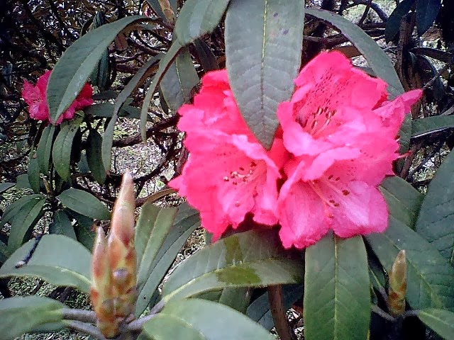
Rhododendron 
2kms trek from Tonglu will take you to another small Village called Tumling located at an altitude of 9,600 ft. Actually from Tonglu to Tumling and all the way up to Gairibas is a gradual descend and the trek is relatively easier. Tumling is a great place to stop for a while, freshen up and then get moving for the next leg of the trek. Some trekkers actually prefer to stay at Tumling for the first night instead of at Tonglu. This is due to availability of better private lodges and facilities here. If you like to do the same, then you can either come here via Tonglu or take the direct gravel road from Meghma. Distance would be more or less the same. Drinking water is available at Tumling. Check out Tumling to know what the place offers including private lodges and attractions. If you take the gravel road from Meghma towards Tumling, initially there are few village huts on both sides of the road. And soon the area becomes quite barren. Tumling is 4kms away along this road. Remember, during the winter time it becomes very cold from Meghma onwards. So take adequate measures to counter the cold (like heavy woolens, caps, gloves etc). Often snow fall takes place along this stretch. About 1km from Tumling you will reach the arch gateway of Singalila National Park, which is the highest altitude national park in the state of West Bengal. This park is well known for rare and fascinating high altitude animals like Red Panda, Pangolins, Himalayan black bear, Monals etc. There is a check post here at Singalila gate.
                                                
  Jhaubari (6kms from Tumling), +3 hours trek

A small village further along the way to Sandakphu at an altitude of 9,186 ft. This place may not be important from trekking perspective. But I always combine trekking with exploration of life in the mountains. And if you do that too, you will like to stop here and have a cup of tea. 

Gairibas (1km from Jhaubari), +0.5 hour trek

From Jhaubari one has to take a right turn towards Gairibas. It is further 1km ahead and located at an altitude of 8,600 ft. From Tonglu or Tumling, up to Gairibas is a continuous descend and a relatively easy trek. This is where you can halt for a while. If you started early in the morning, you can complete your breakfast here or have some tea, before you proceed towards Sandakphu. The trek route passes through bamboo glades. Gairibas is essentially a valley full of bamboo grooves. GTA trekkers huts/lodges are available here and located on the grassy triangular flat land. Because of the scenic beauty of this place, many prefer to stay here for a night before proceeding for Sadakphu next morning. Magnolia Lodge is also popular. During the high season, it may not be easy to get accommodation at Gairibas, unless you have booked it in advance. Drinking water is available at Gairibas.

Kalipokhri (6kms from Gairibas) +3 hours trek 
Lunch with Katla fish 
From Gairibas, you will need to trek for about three hours to reach a place called Kalipokhri (or Kalepokhri) at an altitude of 10,400 ft. Initially you will trek uphill through forests of oak, rhododendrons and bamboo and reach a place call Kaikatta in about 1.5 hours. The trail starts descending from here. In another 1.5 hours or so you will reach Kalipokhri. The place is so named because of a pond or a water tank filled with black water. The word Kali means black and pokhri stands for water area. However the black color is not due to pollution, it's muddy and the water never freezes. Due to all-time water availability, a small village settlement has taken place in this area. You will pass through forest of rhododendron, Singalila Sanctuary and then by the pond to reach the Kalipokhri village area. This is where most of the trekkers stay for the second night. There are several private lodges here including Pandim Lodge, Chewang Lodge, and Himchuli Lodge. There is no GTA lodge here, but the private ones also offer similar accommodations at reasonable rates. Drinking water is available at both Kaikatta and Kalipokhri villages.

Kalipokhri to Sandakphu (6KMS), 3 hour trek

 If you are staying overnight at Kalipokhri, start very early in the morning next day. You will not like to miss out on the panoramic view of the snow peaks from Sandakphu, which is best seen early in the morning. An early start from here will give you a chance to view the snow peaks twice, once as soon as you reach Sandakphu and again next morning before you start your return or onward trek.

 Bikheybhanjang (2kms from Kalipokhri), +40 minutes trek 

From Kalipokhri, the trekking route gradually descends up to Bikheybhanjang which is located 2kms away. On the way you will cross a place called Bhagsa where you can take a break for couple of minutes. Then walk towards Bikheybhanjang. This is another small hamlet. The name means "Valley of Poison" because of the poisonous Aconite plants that grow in abundance around this place. Don't worry, unless you eat the leaves of the plant, it is harmless. Basic lodgings are available at Bikheybhanjang. Villagers also offer their huts as home stays.


  Sandakphu (further 4kms from Bikheybhanjang) 

Sandakfhu

And now the final destination and the climax. You could actually see the Sandakphu Peak from Kalipokhri itself. But like all great things in life, this won't come easy. From Bikhheybhanjang the climb up to Sandakphu is the steepest. The 4kms route can easily take about 2.5 hours. There are stretches where the gradient is so steep that you will think your nose is about to touch the ground. Actually there are two trek routes from Bikheybhanjang, one through Nepal and the other through India. One through India is shorter and more popular although the two routes do merge at places. As always, the final rewards are awesome. All your strains will simply disappear as you see the board saying "Welcome to Sandakphu". You are at an altitude of 11,929ft, on the summit of Singalila range and at the paradise of trekking... Wow, you made it. Sandakphu is the place from where you get a 180 degree panoramic vista of some of the highest and most beautiful peaks of the world, right from Nepal all the way up to Arunachal. Some of the greatest peaks include the Mt Everest, Makalu, Kanchenjunga, Lhotse, Chomolhari, Pandim, Three Sisters, Kumbhakarna etc. Visit  Sandakphu to know about all my experience there and what you can expect. There is a GTA lodge in Sandakphu and also several other private accommodations including Hotel Sherpa Chalet, Hotel Sunrise, Namo Buddha Hotel etc. 
                                                                      
 Singalila National Park:
The park was declared a Wildlife Sanctuary in 1986, and was made an Indian National Park in 1992. The park is located in the Darjeeling subdivision, Darjeeling district, West Bengal, India. It is bordered on the north by the state of Sikkim and on the west by the country of Nepal. The park is part of the Eastern Himalayas. The Singalila Ridge, which runs roughly North to South and separates Himalayan West Bengal from the other Eastern Himalayan ranges to the west of it. The two highest peaks of West Bengal, Sandakphu (3630 m) and Phalut (3600 m), are located on the ridge and inside the park. River Rammam and River Sirikhola flow through the park. The park has no significant history of human settlement. However, small settlements have grown up along the trekking route to Sandakphu and Phalut. There is a reasonably large village at Kala Pokhri, around the lake of the same name. The Singalila Ridge was used as an approach route by the first documented mountaineering team which unsuccessfully attempted to climb Kanchenjunga in 1905. Thick bamboo, oak, magnolia and rhododendron forest between 2000 and 3600 m cover the Singalila Ridge. There are two seasons of wildflower bloom - one in spring (March-April) when the Rhododendrons bloom, and another in the post-monsoon season (around October), when the lower forests bloom (Primula, Geranium, Saxifraga, Bistort, Senecio, Cotoneaster and numerous orchids). Sandakphu is known as the "mountain of poisonous plants" due to the large concentration of Himalayan Cobra Lilies (Arisaema) which grow there. The park has a number of small mammals including the Red Panda, Leopard Cat, Barking Deer, Yellow-throated Marten, Wild Boar, Pangolin and the Pika. Larger mammals include the Himalayan Black Bear, Leopard, Clouded Leopard, Serow and Takin. Tigers occasionally wander into the area, but do not have a large enough prey base to make residence in these forests feasible. The park is a birder's delight with over 120 species recorded including many rare and exotic species like the Scarlet Minivet, Kalij Pheasant, Blood Pheasant, Satyr Tragopan, Brown and Fulvous Parrotbills, Rufous-vented Tit, and Old World babblers like the Fire-tailed Myzornis and the Golden-breasted Fulvetta. The park is also on the flyway of many migratory birds. The endangered Himalayan Newt frequents the region, and congregates around the lakes of Jore Pokhri and Sukhiapokhri and nearby lakes to reproduce. Jore Pokhri and Sukhiapokhri are within 20 km of the park boundary, and are protected wildlife sanctuaries.
 
Useful Information for Sandakphu Trek:  
1) How to book a room/bed in GTA (formerly DGHC) lodge or trekkers hut.
You can book online through GTA website www.gtatourism.com. Alternatively visit any GTA tourism office for booking. Check out Tourist Info for location & contacts of all GTA offices. An indicative rate for a bed in a GTA hut would be about Rs. 200. 
Here are contact numbers of a few private lodges along the trek route:
Jhaubari (Indira Lodge): +91-9733363473
Kalipokhri (Pandim lodge): +91-9742666243
Gurdum (Lakpa Dorjee Sherpa's home):  +91-9593996308
Srikhola (River View Hotel): +91-9733393617/ 8348286798
Sandakphu (Hotel Sherpa Chalet): +91-97727691127 / 9742621760

2) You will need to pay a permit fee for the trek (Rs. 100/- per person). You can pay this fee in Manebhanjan or Singalila National Park entry check post. Without paying this fee, entry through Singalia National Park will not be allowed. Keep photo identity cards (like passport/ driving license etc) handy both in original and photo copy.

3) You are required to take a guide and/or porter from Manebhanjan. Presently the rate is Rs. 400 per day for a porter and Rs 500 per day for guide. You can get current information about rates, permits etc from Highlander Guides and Porters Welfare Association and even make guide/porter bookings through them at a reasonable rate. Phone: +91-9734056944.

4) Other indicative costs for Sandakphu trek (updated February 2014):
Transport from Darjeeling to Manebhanjan: Rs. 75 per person on shared Jeep (full vehicle Rs. 800). Cost of food along the trek route would be Rs. 350-400 per person per day. Rate of dormitory bed in trekkers huts  = Rs. 200-250 per person per day. Rimbik to Darjeeling shared Jeep cost = Rs. 200 per person.

5) Cell phone signals for Vodafone and BSNL will work for most part of Sandakphu route.

6) several lodges along the way use solar power and allow you to charge your mobile phone & camera battery for a small amount.

7) What is the best time to trek for Sandakphu & Singalila?
There are two great seasons: one during April to May when its comfortable (temperature varies between 6 - 12°C) and the flowers like rhododendrons are in full bloom. In May however, there are good chances of occasional showers and the sky remaining cloudy. The second season is between October to November when the temperature ranges between 1 - 6°C, visibility is excellent and there may be occasional snowfall. You can also trek in December but it gets really cold around that time. For trekking in January/February, you will need equipment like snow boots, sleeping bags etc. Identifying trails may be difficult, so take an experienced guide.

My videos of  Sandakphu, Flowers of this region you can watch in YouTube by a single click.
                                  
                                                    Sorry for take your valuable time & thanks for take a look